
Poncione d'Alnasca e Föpia
Information
| Date: | 15 July 2024 |
| Maximum height: | 2301 m |
| Difference in height: | 1910 m |
| Length: | 16 km |
| Kilometers effort: | 41.4 kmef |
| Duration: | 10 hours and 45 minutes |
Difficulties (Automatic translation in english)

|
From the parking area in Alnasca to the fork at the altitude of 2082 metres (with some T2+ passages). |

|
From the fork to the pass at the altitude of 2198 metres. |

|
From the pass to the top of Poncione d'Alnasca (with 1 passage of I+ grade climbing at the altitude of 2245 metres). |
|
|
From the pass at the altitude of 2198 metres to the summit at 2145 metres on the Cresta della Föpia and then the descent to the altitude of around 2100 metres (with some T3 passages). |
|
|
The last section to the summit of Föpia (with some T3+ passages, mainly due to the rhododendrons). |
|
|
From the pass at 2104 metres to the Bocchetta di Cremenzè and then the descent to the fork at the altitude of 2082 metres. |
Comment (Automatic translation in english)
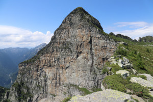
Poncione d'Alnasca is a mountain in the Verzasca Valley famous for its impressive south face that attracts many climbers. Its peak is already visible when crossing the Monte Ceneri Pass and it has always fascinated me every time I saw it. Today I decide that the time has come to climb it.
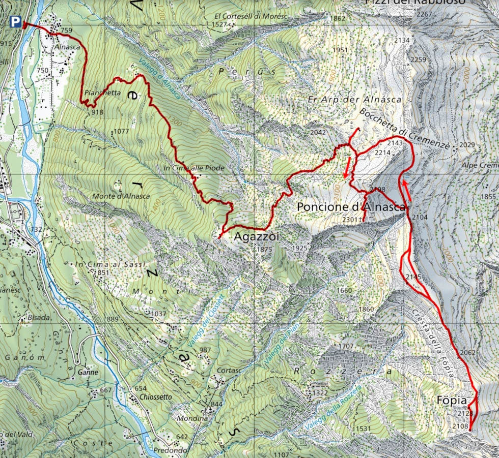
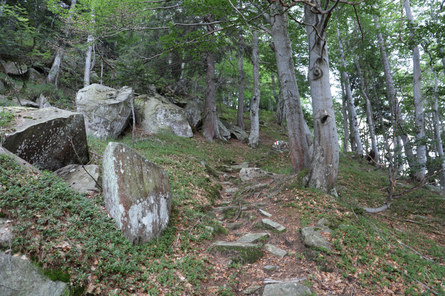
First I reach the parking area along the main road, just after the village of Brione (Verzasca). I then cross the bridge over the river on foot to the village of Alnasca. I then take the path that goes up to Pianchetta and continue up to Cima alle Piode where, just above the buildings, there is the boundary stone of Canton Ticino. I then start to climb again and soon reach Agazzòi, a beautiful panoramic plateau from which there is a wonderful view over almost the entire Verzasca valley. I stop for a bite to eat and then set off again towards Alpe d'Alnasca located at an altitude of 2049 metres, about a hundred metres away from the path. After reaching it and taking a few photos, I return to the official route and climb up to the pass at an altitude of 2198 metres. At that point, all that remains is the last stretch to climb along the north ridge of Poncione d'Alnasca. The path tends to stay on the right side of the ridge and only in the last section, where it widens, does it return to the centre. The way up is not particularly difficult, although it is a little exposed in places. At an altitude of 2245 metres there are some rocks to pass and there is a short I+ grade climbing passage, equipped with a chain to hold on to. On the summit there is a large wooden cross anchored with ropes. The view is stupendous and towards the south I can finally see the Cresta della Föpia, which will be my next destination.
After lunch, I descend again to the pass at an altitude of 2198 metres. I then leave the official trail and start to descend along the meadows towards the east. When I reach the small pass at an altitude of 2104 metres, an impressive, steep gully opens up on my right. On my left I can admire the overhanging Cresta della Föpia. I continue southwards following a slight track that crosses a ledge and takes me to the wide pastures on the other side. After a short ascent, I reach the summit at 2145 metres, from where I can finally admire the south face of Poncione d'Alnasca in all its beauty.
After taking a few photos, I continue following the ridge southwards, which gradually becomes narrower and rockier. Towards an altitude of 2095 metres, I abandon it to descend on the left side. It is here that one of the most tiring sections of the entire trip begins. The slope to follow is quite steep and full of rhododendrons and wild junipers. I struggle to continue and more than once I think ‘but who made me do it!’. Fortunately, after about a hundred metres I find a slight track that makes my walk a little easier. After passing under the pass at an altitude of 2062 metres, I return to the ridge again at an altitude of 2075 metres. At that point, the bushes diminish a little and I am able to continue better. Around an altitude of 2090 metres, there are rocks that I circumvent from the west side, which is still a little exposed. I then reach the north-east ridge of the Föpia, which I climb up to the summit. I then descend southwards until I reach the cross at altitude 2108 metres. From that point there is an incredible view over the lower part of the Verzasca valley.
I stop for a short while because it is starting to get late and the route to Alnasca is still long. I turn back to the pass at 2104 metres, following roughly the same route as on the way up. However, I avoid climbing back up to the Föpia and the summit listed at 2145 metres, passing instead further to the right and lower down. I then head towards the Bocchetta di Cremenzè, so as to save more than 50 metres of ascent, after which I descend to the fork at altitude 2082 metres. Following the same route as the outward journey, I finally return to Alnasca and the parking area where this long excursion ends.
Water (Automatic translation in english)
There is a fountain at Alnasca, one at Agazzòi and finally one at Alpe d'Alnasca. There is also a stream at an altitude of 1878 metres, which may be dry in dry periods.
Map of the Path

Summits


Comments (1)