Pizzo del Ghiacciaio di Sasso Nero

Information
| Date: | 8 September 2023 |
| Maximum height: | 2742 m |
| Difference in height: | 1020 m |
| Length: | 10.5 km |
| Kilometers effort: | 24.1 kmef |
| Duration: | 7 hours |
| Huts reached: | Rifugio Sasso Nero |
| Lakes reached: | Lago della Zotta |
| Lago di Laiòzz |
Difficulties (Automatic translation in english)
Comment (Automatic translation in english)
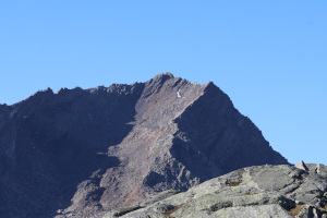
After the last few fairly long hikes, today I decide to do something lighter but still take me to altitude, as the days are still warm. Looking in the Naret region, I find a little-visited mountain with a very long name: the Pizzo del Ghiacciaio di Sasso Nero. I therefore decide to climb this peak and, while I am in the area, to also go and see Lago della Zotta.
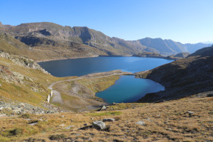
First I reach Lago del Naret, at the top of the Val Lavizzara. I then start walking, following the path up to the Sasso Nero pass and then descend into the Peccia valley until I reach the Sasso Nero hut. After taking a look inside, I set off in the direction of Lago della Zotta. The fog begins to rise in the valley but luckily I manage to reach the lake and photograph it before everything is hidden by it.
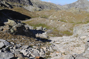
I then set off again in a westerly direction and after about 300 metres I reach the first rocks. I cross them and begin to climb until I reach an altitude of 2440 metres where I encounter a moraine. I pass it and notice that on the other side the terrain becomes easier and the rocks are smaller. I probably could have reached the moraine by an easier route if I had climbed directly from the Rifugio Sasso Nero towards the south-southwest. In doing so, however, I would have had to give up the view of the lake.
From the point where I am now, I therefore climb up the little valley that leads to the summit, staying mainly on the west side where the terrain is a little easier. I arrive in this way at a small nozzle at an altitude of 2837 metres and after a short ascent to the right I reach the summit of Pizzo del Ghiacciaio di Sasso Nero. On the summit I find a small stone cairn and a small broken cross.
For the return I follow a different route than the one taken on the way up because I want to go and see the Lago di Laiòzz. I descend again to an altitude of 2620 metres and then head towards the nameless pond at an altitude of 2381 metres. In the first part of the descent, there are still some rocks to cross, which then end up at an altitude of 2480 metres. When I reach the small lake, I cross it and after a short climb I reach the path coming from the Bocchetta del Lago nero, which I follow to the right until I reach the Lago di Laiòzz. On the other side of the pond I find a slight track that climbs to the north-east and I begin to follow it. Every now and then there are some paint marks and a few stone cairns. Towards an altitude of 2440 metres, the track continues on the level and, going around the peak at 2486 metres, in a counter-clockwise direction, reaches the official path coming from the Val del Coro. In this last section, the trail had almost completely disappeared and I had a little trouble following it. Even the little stone cairns and paint marks were few. Nothing serious though because the terrain was not dangerous.
Following the path I had just reached, I therefore returned to Lago del Naret, where I ended this outing.
Water (Automatic translation in english)
Shortly after the start there is a stream just before the building at an altitude of 2331 metres and then there is the Fiume Peccia just after the Sasso Nero hut. On the way back, there is a stream that enters the unnamed pond at an altitude of 2381 metres, and a little further on, the Peccia River is encountered again before arriving at the Lago di Laiòzz.


Comments (0)