
Pizzo Bombögn
Information
| Date: | 4 November 2024 |
| Maximum height: | 2331 m |
| Difference in height: | 860 m |
| Length: | 8 km |
| Kilometers effort: | 19.4 kmef |
| Duration: | 4 hours and 45 minutes |
Difficulties (Automatic translation in english)

|
From the parking area to the fork at the altitude of 1994 metres (with 1 T3 passage, equipped with chains, 360 metres before the fork). |

|
The ascent to the altitude of about 2250 metres. |

|
The last stretch to the top of Pizzo Bombögn, either following the path or climbing up the wall (from the altitude of 2215 metres). |
Comment (Automatic translation in english)
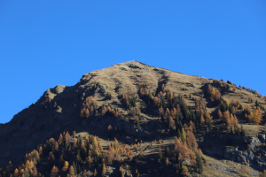
Given the very mild weather in the mountains, despite the fact that it is already November, I decide to do one more summit above 2000 metres. Pizzo Bombögn and its famous wall, which I have not yet seen, comes to mind.
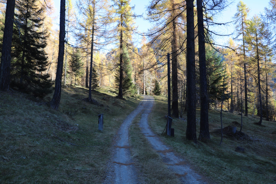
First I reach the village of Cimalmotto in Valle di Campo, after which I climb up to the parking area just below Schièda di Sopra. I then start to walk along the dirt road that goes up to Corte Nuovo, passing through a forest of larch trees that are now almost completely yellow. There is no one around and even nature is silent. I then take the path that climbs northwards and leads to Piano delle Rose. However, when I arrive at the bend at an altitude of 1570 metres, I mistaken the path for a moment. At that point, there is in fact a well-marked track that continues eastwards on a slight descent. The right path instead climbs to the left, but in that place it is barely visible and not marked at all, and only above the altitude of 1600 metres is it better seen. In some places it must also have been redone because its route does not correspond perfectly with the national map. The climb is quite steep up to an altitude of 1920 metres, after which the route continues to the right at a slight gradient. There is an easy scree slope to cross and then a short section that is a little steep but equipped with chains. I then arrive at the fork at altitude 1994 metres where I meet the path coming from Campo (Vallemaggia). I continue slightly uphill and after 120 metres arrive at a second fork, marked by an iron pole. The official path continues straight on towards Pian Cròsg while on the left begins the light track that climbs to Pizzo Bombögn. I follow the latter to an altitude of 2215 metres where I reach the wall, about 2-3 metres high and about 60-80 cm wide, that descends from the summit. This was built in 1948 to prevent goats, from the area called Piòda di Bombögn, from reaching the recently created larch and stone pine plantations on the slope of the mountain towards Campo.
At this point, it is possible to climb to the top by continuing to follow the slight track that passes to the left of the wall or walk directly up it. I choose the second alternative, leaving the path for the return. In fact, I recommend avoiding descending passing over the wall because it is steep and in some places the rock steps are blunt and only 10 cm deep and you risk slipping. Having arrived at an altitude of 2275 metres, I reach a break in the wall where there is a large boulder (see photo). Climbing it is not easy because it is quite steep, so I decide to go around it on the left. After returning to the wall, I climb the last 50 metres of altitude difference and I am at the summit. On the other side, the Valle di Bosco Gurin appears with the village still partly shrouded in shadow despite the fact that it is already past noon.
After the lunch break, spent in short sleeves because of the mild weather, I start to descend again. As I said before, this time I follow the track across the meadows, which is a little steep at first. I then take the path that descends to the fork at altitude 1994 metres and follow the same route as before to return to Corte Nuovo and finally to the parking area.
Water (Automatic translation in english)
There are several fountains in Corte Nuovo but only one was working at the time. Afterwards, I could not find any more.
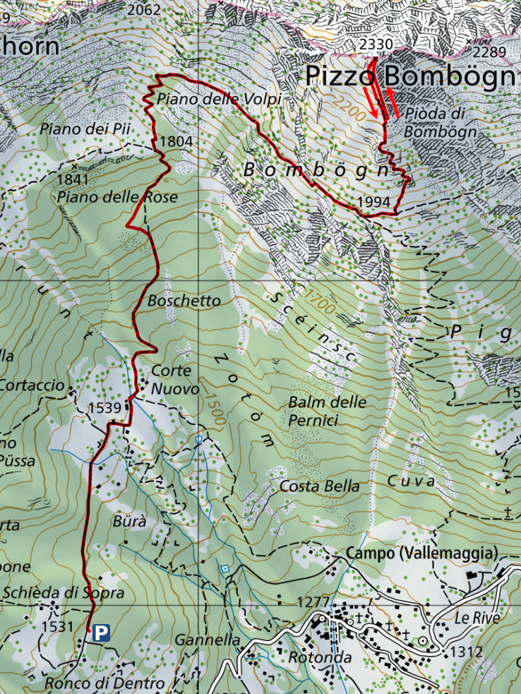
Map of the Path

Summits


Comments (0)