
Motto della Croce, Motto d'Arbino e Sasso Guida
Information
| Date: | 19 June 2024 |
| Maximum height: | 1713 m |
| Difference in height: | 900 m |
| Length: | 11.5 km |
| Kilometers effort: | 23.5 kmef |
| Duration: | 5 hours |
| Huts reached: | Capanna Genzianella |
Difficulties (Automatic translation in english)

|
From the Monti di Ravecchia to Motto d'Arbino at the altitude of 1691 metres (T1 the first section on the road). |

|
The ascent up to Motto d'Arbino at the altitude of 1701 metres, and then the descent to the pass at the altitude of 1622 metres. |
|
|
The ascent to the Sasso Guida (T2+ the last 15 metres before the summit) and then the descent to the Monti di Ravecchia. |
Comment (Automatic translation in english)
Today, as the weather is expected to worsen in the afternoon, I decide to take a not-too-long hike. I therefore choose to climb Motto d'Arbino and Sasso Guida, two peaks above Bellinzona.
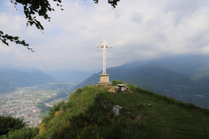
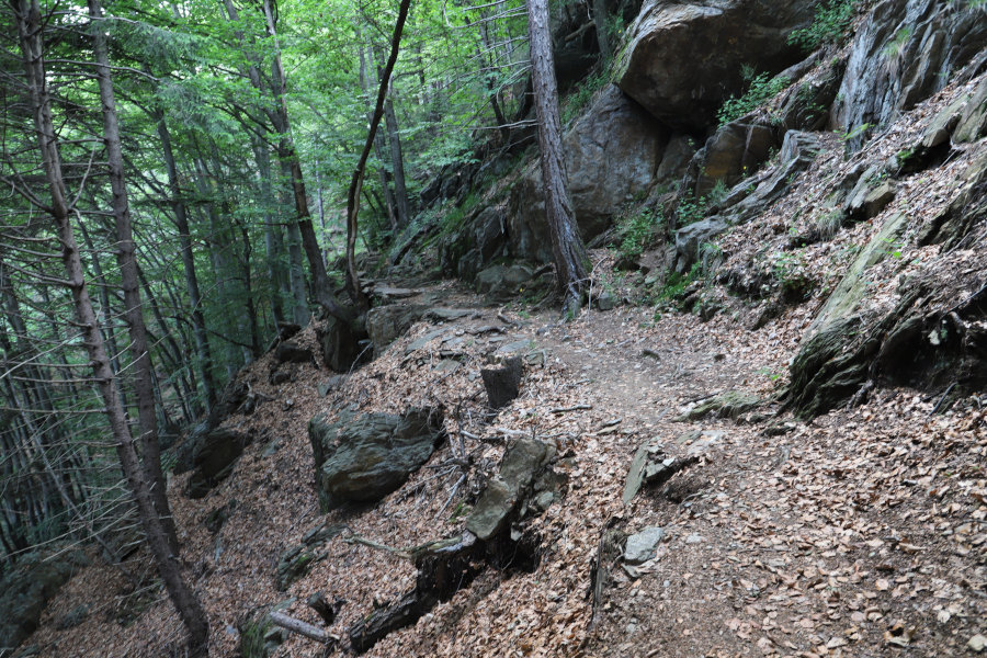
First I reach the Monti di Ravecchia, where there is a large car park. I then start walking along the road, which is closed to traffic, leading to the Monti d'Artore. I then climb along an easy path until I reach Motto della Croce, from where I can admire the entire plain between Lake Maggiore and Biasca.
I take a short break and start climbing again towards Arbinetto. The path has a slight and constant gradient and is not very strenuous. I then continue until I reach the top of Motto d'Arbino where I find a large meadow with a military installation and some antennas. While I'm at it, however, I also want to climb to the south-east summit, which is also about ten metres higher. I therefore descend to the fork at altitude 1679 metres and take a small path that climbs on the other side of the road. Following it, I soon reach the second summit.
Not wanting to turn back, I now decide to follow the entire easy ridge that descends to the east to the pass at altitude 1622 metres. In that place, on the national map, the Laghetti della Costa are marked, but in reality there is only one small lake. At that point I find the path again, which I follow eastwards until I reach the summit of the Sasso Guida. On its summit I find a small military shelter from the First World War and above it a cross.
I stop to have something to eat and then descend again to the pass that I had already reached earlier. I then take the path heading west and follow it to Piano Dolce, where there is the Capanna Genzianella (not marked on the national map). I refuel with water and then set off again in the direction of the Monti di Ravecchia, where this excursion ends.
Water (Automatic translation in english)
There is a fountain at Monti di Ravecchia and then one on the way up to Motto della Croce at an altitude of 1068 metres. Very little water came out of the latter, however, perhaps because it was obstructed. I then found a basin with a channel from which a lot of cold water gushed out just before Arbinetto. On the way back, I found a fountain at Piano Dolce (at an altitude of 1357 metres) and one at Monti della Zota.
Map of the Path


Summits
Huts
Other


Comments (0)