
Pizzo Lucendro

Information
| Date: | 15 September 2005 |
| Maximum height: | 2962.7 m |
| Difference in height: | 940 m |
| Length: | 14 km |
| Kilometers effort: | 26.5 kmef |
| Duration: | 6 hours |
Difficulties (Automatic translation in english)

|
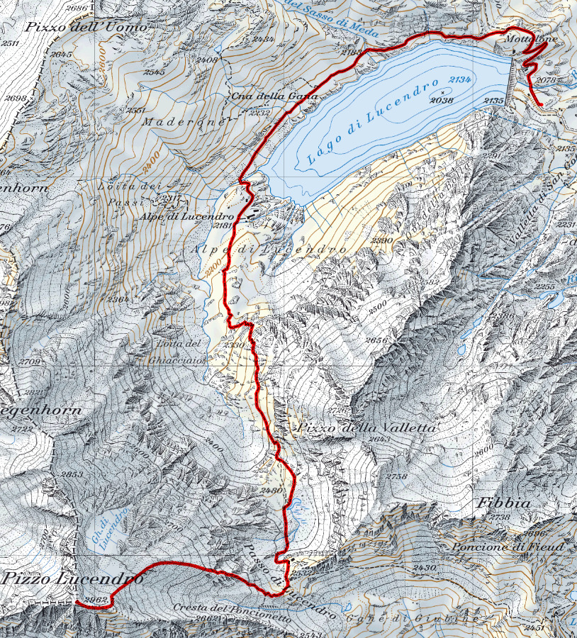
From the Lucendro dam to Alpe di Lucendro. |

|
From the Alpe di Lucendro to the Lucendro Pass. |

|
From the Lucendro Pass to the altitude of approximately 2860 metres. |

|
The last 100 metres to the summit. |
Comment (Automatic translation in english)
For this hike, you can leave your car below the Lucendro dam where there is a large clearing.
You start walking along the asphalt road, which after a few hundred metres becomes a dirt road. You thus skirt the entire lake until you reach Alpe di Lucendro. Here, continue along the well-marked path that climbs southwards to the Lucendro pass. We then continue westwards along a moraine and slowly turn southwards towards the anticima located to the east of the summit at an altitude of around 2920 metres. We then follow the ridge to the summit, where there is a weather station and a cross.
For the return, follow the same route as on the outward journey.
Map of the Path

Summits


Comments (2)