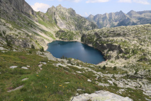
Laghetti d'Antabia e Laghi della Crosa

Information
| Date: | 10 July 2023 |
| Maximum height: | 2465 m |
| Difference in height: | 1900 m |
| Length: | 23 km |
| Kilometers effort: | 48.3 kmef |
| Duration: | 11 hours and 30 minutes |
| Huts reached: | Capanna Piano delle Creste |
| Rifugio Crosa |
| Lakes reached: | Laghetto d'Antabia Piccolo |
| Laghetto d'Antabia Grande | |
| Lago della Crosa Grande | |
| Lago della Crosa Piccolo |
Difficulties (Automatic translation in english)
Comment (Automatic translation in english)
I had wanted to see the Laghetti d'Antabia and Laghi della Crosa for several years. Today I decide to do the whole tour in one day, even though the trip is quite long.
First I reach the village of San Carlo in Val Bavona where, just before the bridge, you can leave your car along the roadside. I then start walking along the path that climbs into Val d'Antabia. At an altitude of 1809 metres, I reach a river that I cross thanks to some large concrete blocks placed about 1 metre apart. Continuing to climb, I soon reach Corte Grande, from where there is a splendid view of the Val Bavona. At this point, the path becomes less steep and towards an altitude of 2060 metres I arrive at a beautiful plateau full of grass and crossed by a river. At the bottom I can already make out the Capanna Piano delle Creste, which looks down on me from above and which I soon reach.
I stop for a moment to eat something and then set off again in a southerly direction, towards the Laghetti d'Antabia. I soon reach them and continue towards Bocchetta della Crosa, the highest point of this excursion. In the first part of the ascent, I cross some easy scree. Then, towards an altitude of 2410 metres, we reach the base of a rocky wall, which we walk along until we reach the Bocchetta. This last section is the most treacherous because there is a lot of gravel on the path. However, there are numerous chains to hold on to in order to climb.
Once past the small pass, I begin the descent into Val Calnègia, along a scree slope, until I reach the small lake at an altitude of 2388 metres. I then continue along a somewhat easier path that after several ups and downs takes me to the Laghi della Crosa. Near the smaller one, in an enchanting spot almost overlooking the lake, is the Rifugio Crosa.
Time begins to run out and there is still a long way to go. After an ascent to an altitude of 2204 metres, I descend to Alpe della Crosa and continue until I reach the valley floor. I then pass the villages of Calnègia and Gerra along a slightly downhill path. At an altitude of 923 metres I reach a bridge that crosses the river and leads to Splüia Bèla, an ancient dwelling built under some large boulders in which the alpine people once lived. There are other dwellings of this type (splüi) in the valley, but this one is certainly the most famous. Unfortunately, evening is approaching and I don't have time to visit it. It will be for next time.
I then continue my descent down the valley and soon reach Puntid, where there is a beautiful stone bridge that allows me to cross the river. The latter, a little further down, reaches a large rocky drop and, falling, forms the famous Foroglio waterfall. The path also has to cross this jump and it does so thanks to stone walls built along the rock face.
Having passed this section, I continue north without descending to the village of Foroglio to avoid losing altitude unnecessarily. I then reach the road at Roseto and climb it, passing the villages of Fontanellata and Sonlerto, until I reach San Carlo again, where this long excursion ends.
Water (Automatic translation in english)
In Val d'Antabia there is a fountain at Corte Grande and then one at the Piano delle Creste hut. From an altitude of 1740 metres up to the hut there are also several streams.
In Val Calnègia I found a fountain at Calnègia and then one at Puntid. From an altitude of 1714 metres down there are also some streams but you have to be careful because cows graze in some areas. At Rifugio Crosa there is a pipe from which some water comes out. This, however, comes from the lake and one of the people who runs the hut advised me against drinking it.
Finally, at the bottom of the Val Bavona valley, I found a fountain at Fontanellata and one at San Carlo, after the bridge.


Comments (0)