
Giro della Greina

Information
| Date: | 24 July 2005 |
| Maximum height: | 2357 m |
| Difference in height: | 1310 m |
| Length: | 26 km |
| Kilometers effort: | 43.4 kmef |
| Duration: | 9 hours |
| Huts reached: | Capanna Scaletta |
| Capanna Motterascio |
Difficulties (Automatic translation in english)

|
From Alpe di Fontana San Martino to Pian Geirètt. |

|
From Pian Geirètt to Capanna Motterascio and then down to Garzott. |
|
|
From Garzott to Alpe di Fontana San Martino (except for one piece still T2). |
Comment (Automatic translation in english)
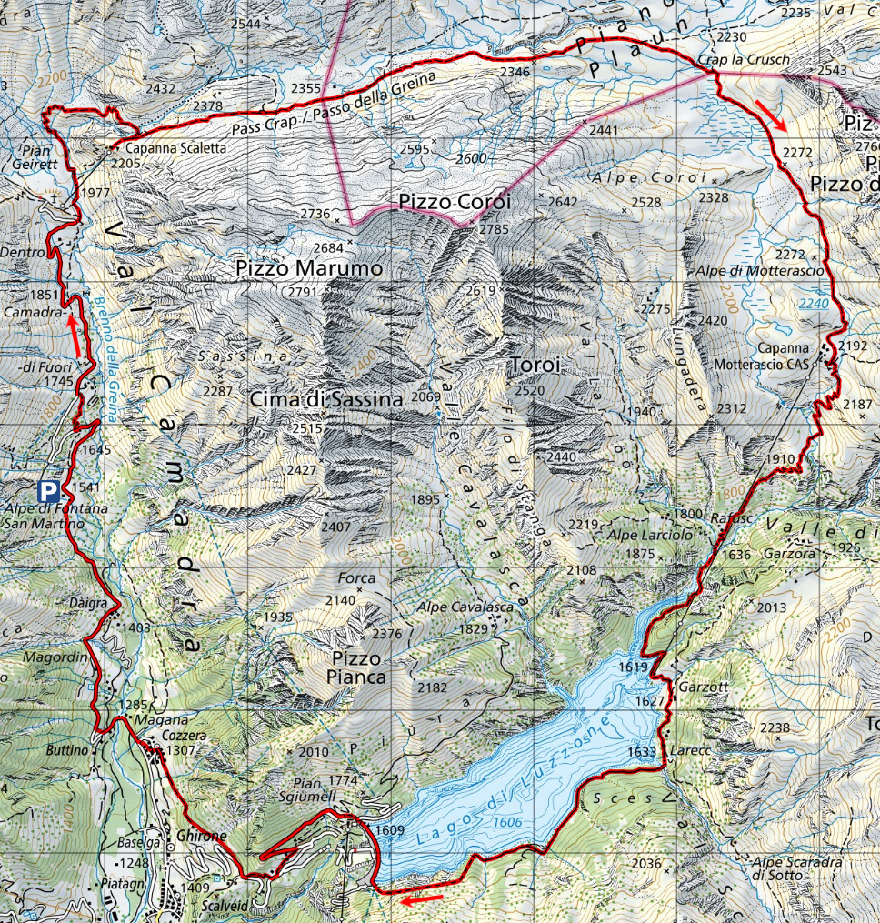
We started from the Alpe di Fontana San Martino, where there is a large car park just before the barrier. Following the road and then the path, we then reached the Capanna Scaletta. Once there, we headed towards the Greina pass, a fairly rocky and very beautiful area. After the pass, we enter Greina territory, and the rocks give way to meadows. Once we reached the fork at Crap la Crusch, instead of going to the Capanna Terri, we headed to the Capanna Motterrascio (Michela), which was being extended at this time. We then descended to Lago del Luzzone and later reached Cozzera. From that point we had to start climbing again until we returned to the parking area from which we started.
Map of the Path

Huts
Other


Comments (0)