
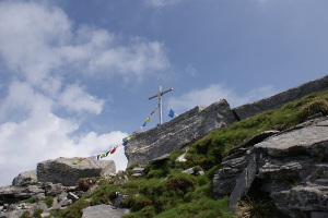
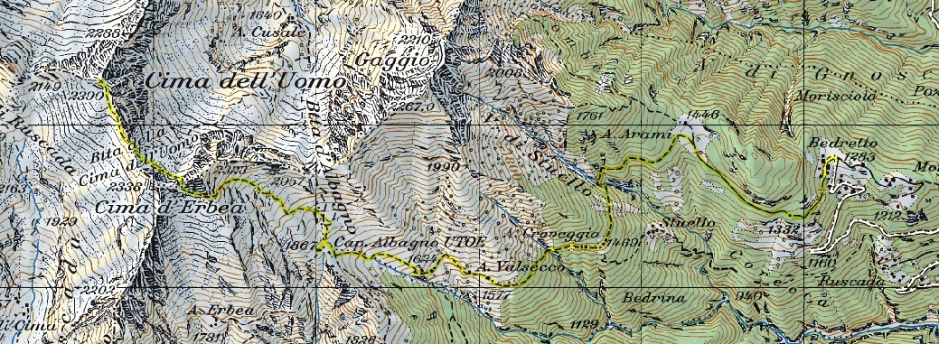
Cima dell'Uomo
Information
| Date: | 26 June 2008 |
| Maximum height: | 2390 m |
| Difference in height: | 1400 m |
| Length: | 13 km |
| Kilometers effort: | 31.7 kmef |
| Duration: | 9 hours |
| Huts reached: | Capanna Albagno |
Difficulties (Automatic translation in english)

|
From Bedretto to the Alpe di Arami. |

|
From Alpe di Arami to Capanna Albagno. |

|
From the hut to Bocchetta d'Erbea. |

|
From the pass up to the Cima dell'Uomo. |
Comment (Automatic translation in english)
To climb up to the Capanna Albagno hut, you can start from Bedretto, where there is a large car park, or take the cable car up to Mornera. From Bedretto you then follow the path that runs along the entire Gorduno Valley until you reach the hut. From here, first go up towards Bocchetta d'Albagno and then deviate towards Bocchetta d'Erbea. Once reached, descend for about 60 metres on the other side and then climb up to Bocchetta della Cima dell'Uomo. From the latter, the summit of the same name can be reached in a short time, passing through a small passage that is not too difficult, I+ grade climbing. For the return, the same itinerary can be followed.
Water (Automatic translation in english)
There is a fountain at Capanna Albagno and a few streams before it.
Map of the Path

Summits
Huts


Comments (0)