
Cima del Masnee
Information
| Date: | 9 July 2024 |
| Maximum height: | 2206 m |
| Difference in height: | 1720 m |
| Length: | 15.5 km |
| Kilometers effort: | 38.4 kmef |
| Duration: | 10 hours and 15 minutes |
| Huts reached: | Rifugio Alpe Masnee |
| Lakes reached: | Lago del Starlarèsc da Scimarmòta |
Difficulties (Automatic translation in english)

|
From the road before Ponte Scuro to the Starlarèsc Lake by Scimarmòta (with a few T2+ passages). |

|
From Scimarmòta to Corte di Cima, at the altitude of 2069 metres. |

|
From Corte di Cima up to the pass at the altitude of 2119 metres and then the ascent to the altitude of about 2150 metres. |

|
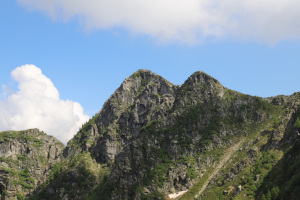
The last 50 metres to the summit of Cima del Masnee. |
|
|
From the altitude of 2150 metres to the Rifugio Alpe Masnee. |
|
|
From the refuge to the pass at the altitude of 2119 metres. |
Comment (Automatic translation in english)
After having been to the Starlarèsc Lake from Sgióf last year, this time I want to go to the one from Scimarmòta. Again, I am not only satisfied with the lake but I will also climb to the Cima del Masnee.
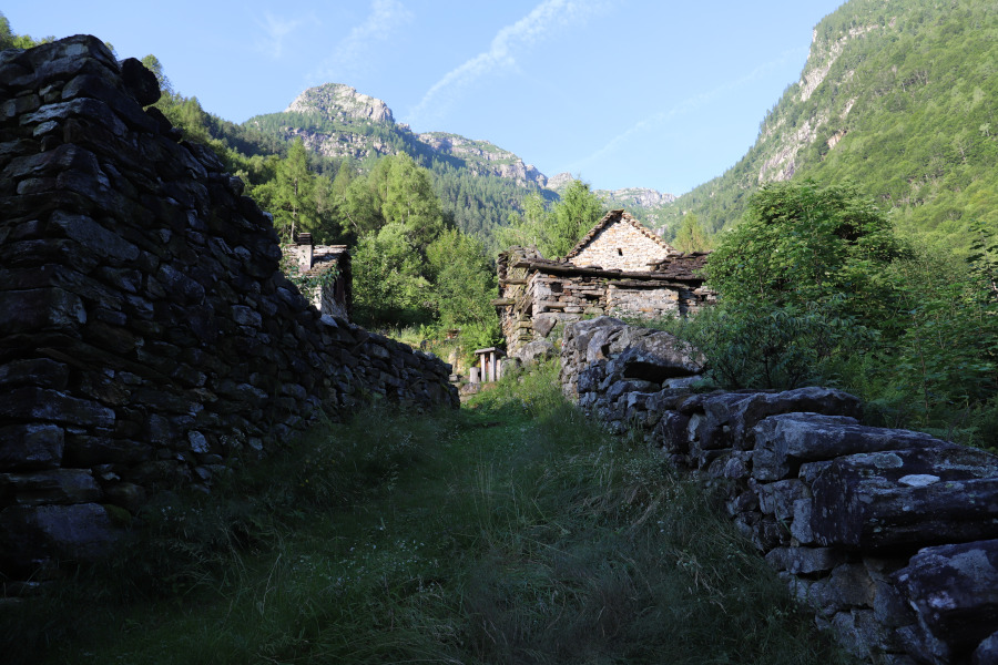
I start walking along the road that leads to Ponte Scuro and then I take the path that goes up to Sparvé. In some places you have to be careful because there are several wet rocks and you risk slipping. I then continue the long climb until I reach Scimarmòta. The path is quite beautiful, although towards an altitude of 1440 metres it has been somewhat ruined by an avalanche that uprooted some trees and caused some earth to collapse. Another short stretch and I finally reach Lake Starlarèsc from Scimarmòta.
After circling the lake and taking many photos, I descend to Scimarmòta and then climb to the alp at altitude 2069 metres (which is called Corte di Cima on the internet). I then continue southwards, descending about 40 metres in altitude, and then climb back up to the pass at altitude 2119 metres. Along this stretch the rocks begin to increase, especially in the final part where you also have to cross a ledge less than a metre wide and somewhat exposed. However, there are some chains to hold on to.
Having reached the vent, I descend a few metres into the Maggia Valley and then leave the path and follow the ridge that climbs towards the east. At a certain point, I continue on its southern slope following a slight track until I am about a hundred metres from the summit. I then cross a scree slope and on the other side begin to climb the last 50 metres, which are a little steep, until I reach the Cima del Masnee. From the summit I catch a glimpse of the Starlarèsc da Sgióf lake, which I reached last year.
After the lunch break, I descend to an altitude of 2140 metres, after which I head south until I reach the path coming from the Deva Pass. Following it, I soon reach the Rifugio Alpe Masnee, a hut consisting of several buildings in which the various services are distributed.
After taking several photos, I set off again along the path that leads to the pass at an altitude of 2119 metres. Once past it, I descend to Ponte Scuro following the same route as in the morning.
Water (Automatic translation in english)
There is a fountain in Ponte Scuro and then one at Scimarmòta. There is also one at the Alpe Masnee refuge, but the water is not drinkable. In addition to this, there are several rivers and streams along the path up to Lake Starlarèsc from Scimarmòta. Higher up, there is hardly anything to be found.
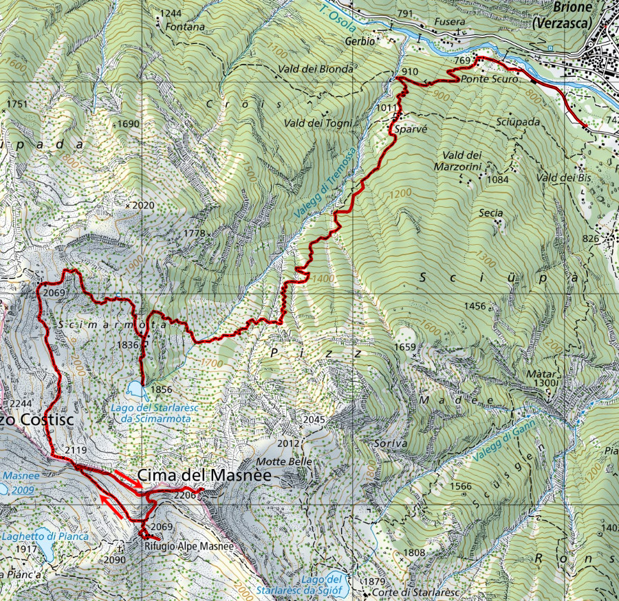
Map of the Path

Summits
Huts
Lakes


")


")


Comments (0)