
Capanna Gariss
Information
| Date: | 10 September 2024 |
| Maximum height: | 1439 m |
| Difference in height: | 1270 m |
| Length: | 16 km |
| Kilometers effort: | 32.9 kmef |
| Duration: | 7 hours and 15 minutes |
| Huts reached: | Rifugio Alpe di Lai |
| Capanna Gariss |
Difficulties (Automatic translation in english)

|
Along the entire route (with some T2+ sections on the path from the fork at altitude 769 metres down to Moleno). |
Comment (Automatic translation in english)
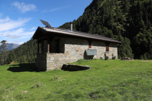
I have been wanting to go up to the Capanna Gariss in the Moleno Valley for a while now, and today is the right day. It is indeed windy in the high mountains and I prefer to stay at a lower altitude.
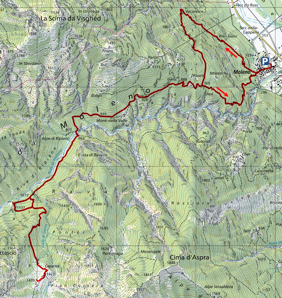
First I reach the hamlet of Moleno, where there is a car park right next to the cemetery. I then cross the village and take the path up the mountain until I reach the fork at an altitude of 283 metres. At that point you can turn left and follow the more direct route, or go right and take the longer but less steep path. Since I want to do both routes, I start to climb following the gentler one that leads to Vacaresce. Having arrived there, the path turns south and after reaching Gàisc, it finally enters the Moleno Valley where its gradient decreases considerably. Near Alpe di Ripiano I reach a beautiful stone bridge that spans a rather impressive gorge through which the Riale di Moleno flows. Having crossed the bridge, the path continues along the other side of the valley until it reaches the Alpe di Lai hut at an altitude of 1109 metres. Just above the hut, I take the path that turns left and leads me to the Capanna Gariss. The whole of the ascent I had just made was in the forest, whereas now, around the hut, I finally find a wide pasture with a beautiful panorama. In the distance I can see the mountains around Cima di Biasca and even further away is Adula, which is now partly covered by clouds. Behind me are the two Cime d'Erbea (altitude 2338 and 2324 metres) with their impressive rock faces.
In the early afternoon, I start to descend again. Just before the Rifugio Alpe di Lai I take a shortcut and follow the unofficial path that descends directly to the altitude of 1072 metres. I then continue along the same route that I followed on the way up to the fork at altitude 769 metres. At that point I follow the direct route down to Moleno. This path is a little less beautiful in places than the one I followed on the way up because it is a little steeper and there are more stones along the way. Having arrived in the village, I return to the car park where this excursion ends.
Water (Automatic translation in english)
There are two fountains at Moleno and one at the Capanna Gariss. Then there is the Riale di Moleno, which can be reached near the Alpe di Ripiano, and some streams before the Alpe di Lai hut.
Map of the Path

Huts
Other


Comments (0)